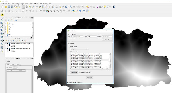
OGC service

A number of Open Geospatial Consortium (OGC) compliant layers are hosted on the WorldPop SDI’s Geoserver instance. Each layer has an associated URL link which allows users to link WorldPop population disaggregation visualisations to their maps.

Please visit https://ogc.worldpop.org/geoserver/web/

GIS Plugins

The WorldPop SDI has developed a number of QGIS and ArcGIS plugins to facilitate the access of WorldPop data through desktop GIS applications, as well as R and Python packages that stakeholders can import into their own software in order to make use of WorldPop datasets.

Please visit WorldPop Github page to get a list of all GIS Plugins developed in the WorldPop research group. https://github.com/wpgp